


Itinerary
- Optional: Meet outside Euston/Birmingham New Street/Crewe train station and board The Caledonian Sleeper train for an overnight journey to The Scottish Highlands (bed in a twin-share, single-sex room)
- Meet your guide in Inverness (airport/train station) at 10am and be transported to Fort William
- Pack your bags and begin your hiking journey into the Highland wilderness
Distance: 15 km
Ascent/Descent: 150m/100m
Hiking Time: 4-6 hours
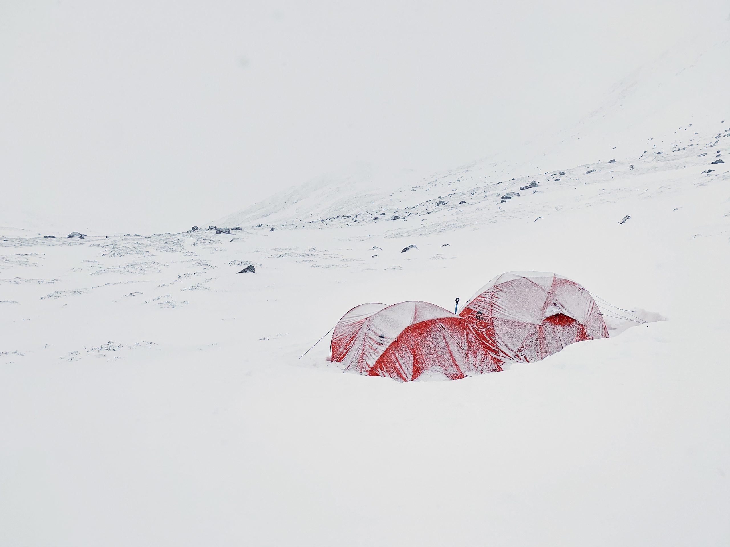
- You will hike c.15km through Cona Glen to your first remote wild camp in the heart of the Glen
- Your guide will demonstrate how to pitch the tents before assisting in preparing food for your first al fresco dinner on the trail
Distance: 23 km
Ascent/Descent: 500m/500m
Hiking Time: 8-10 hours
- Breaking camp we will continue our journey through the Glen towards the famous Glenfinnan viaduct (of Harry Potter fame). We will get away from the day-tripping crowds and pitch camp for our second night.
Distance: 15 km
Ascent/Descent: 600m/600m
Hiking Time: 6 hours
- We will make our way north over our first mountain pass to a remote valley and loch for our third night wild camping.
Distance: 15 km
Ascent/Descent: 450m/500m
Hiking Time: 6-8 hours
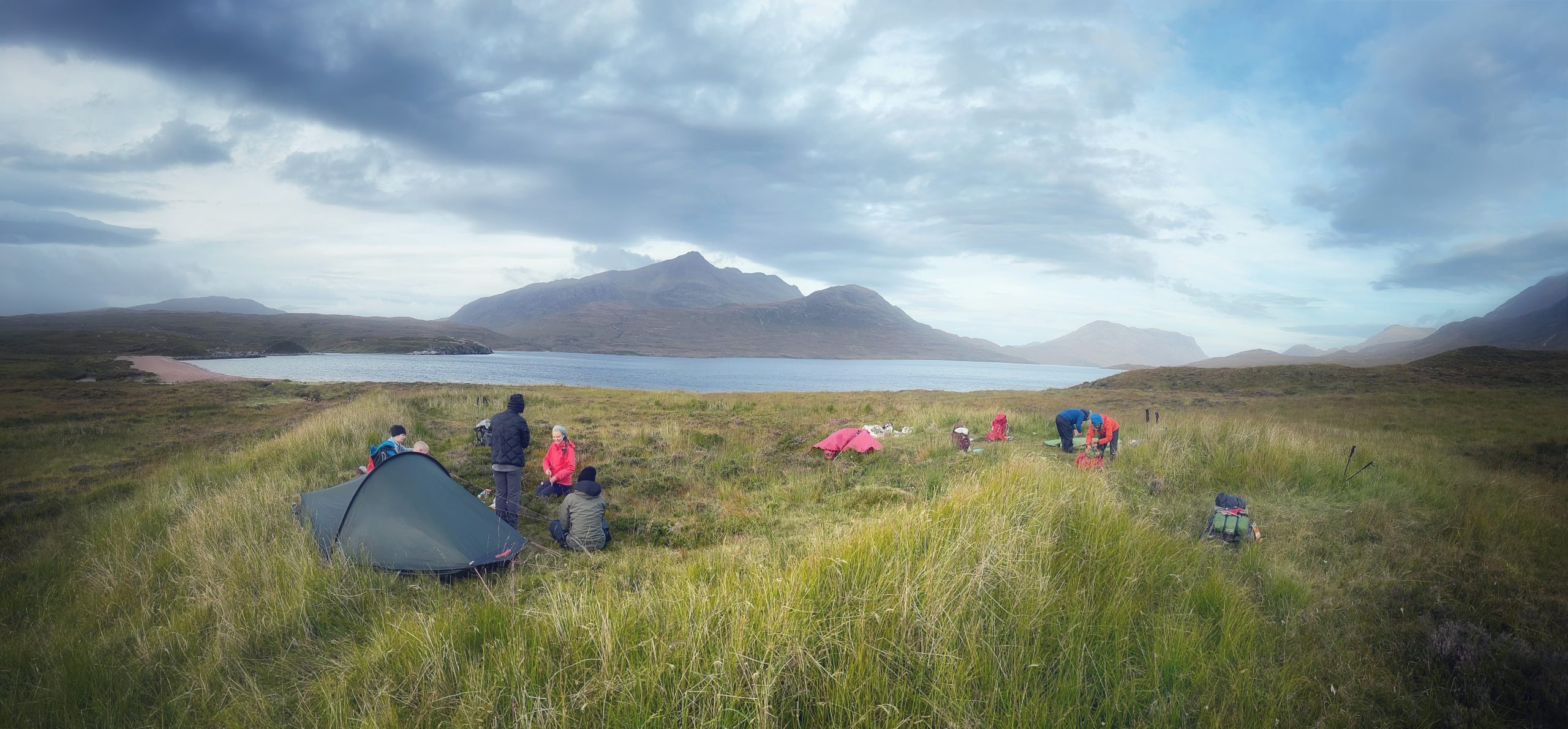
- We will hike up the valley and down to a beach next to a sea loch only accessible by long hikes or by boat for our night of wild camping (and a swim in the sea?)
Distance: 15 km
Ascent/Descent: 600m/600m
Hiking Time: 6-8 hours
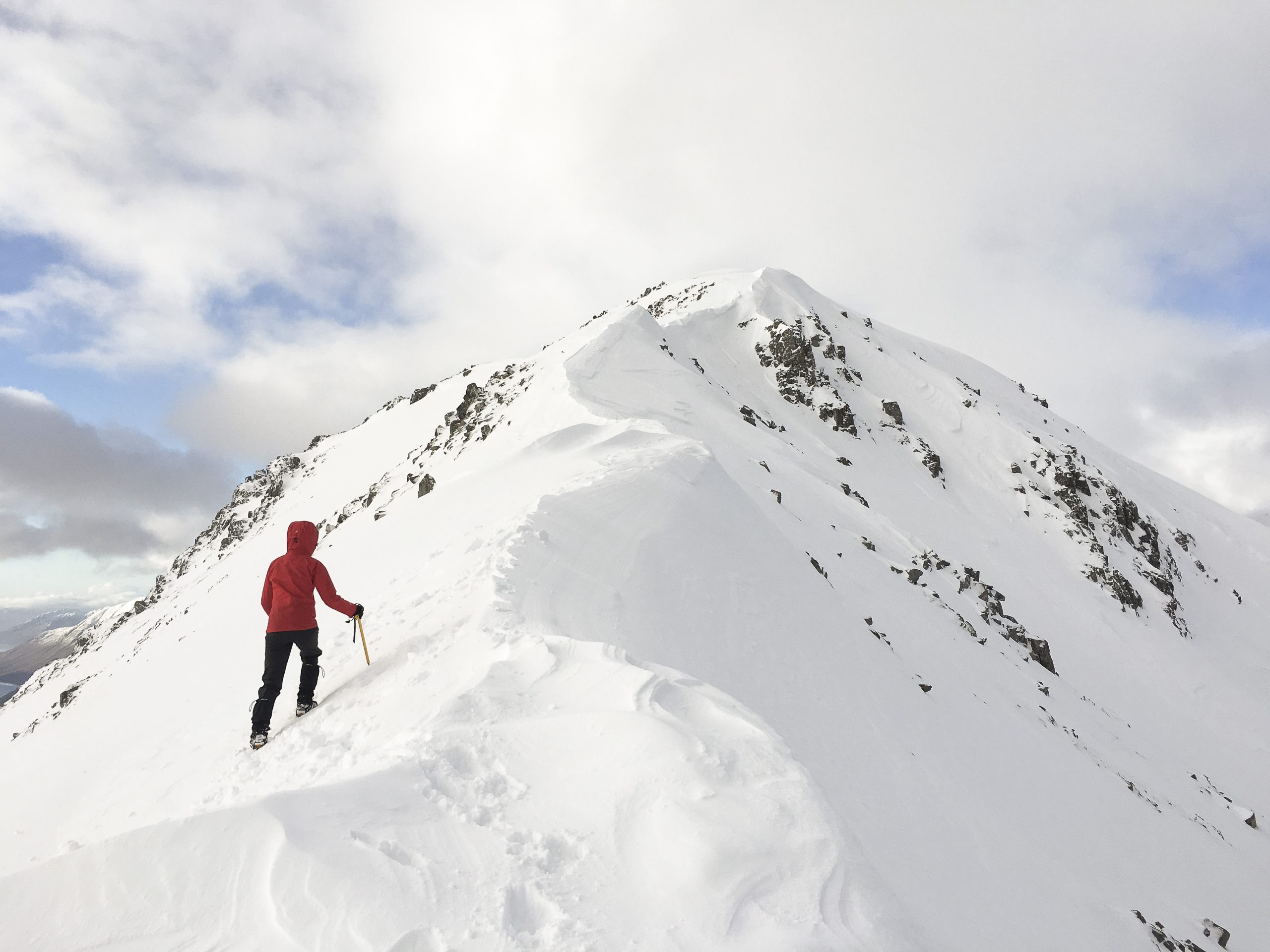
- Today will see us hike north and up towards Knoydart – The UK’s ‘last great wilderness’. You will hike a high mountain pass before descending Barrisdale Bay (or maybe a high pass camp if the weather allows).
Distance: 12 km
Ascent/Descent: 450m/450m
Hiking Time: 4-6 hours
- This is a relatively easy day, as you hike along the shores of the sea loch towards the region of Glenshiel.
Distance: 22 km
Ascent/Descent: 970m/970m
Hiking Time: 9-11 hours
- You complete the final day of this section on the toughest terrain as you hike over another high mountain pass to the beautiful region of Kintail.
- You will spend a night in a hostel next to the coast for a well earned shower and delicious pub meal.
- For those departing, you will be transported to Inverness around midday (expect to be in Inverness for 1pm) for your return home
- Optional: Board The Caledonian Sleeper train at 7pm for a relaxing journey to London/Birmingham/Crewe. The train is scheduled to arrive at London Euston around 8am on Monday
- For those staying on for Week-2 of the adventure, you will have the morning to explore the local area before the group arrive in the afternoon before heading out on a short hike – on to Stage 2 of The Cape Wrath Trail
| Guided hiking by a highly experienced and qualified Mountain Leader |
| Travel and logistical Support from Inverness |
| All food whilst hiking – excluding any pub/restaurant/café meals throughout the hikes. |
| All accommodation (tents provided for wild camping sections, hostels/bunkhouses/B&Bs) |
| Return transport between London and Inverness |
| Your personal hiking kit |
| Food & drink before/after the hike and on any rest days |
Note: The weather and ground conditions will not be known until closer to the date and full winter conditions, whilst expected at this time of year, cannot be guaranteed. The trip will go ahead regardless of conditions (The only exception being if the prevailing weather is too dangerous e.g. Thunderstorms)
Clicking the ‘Add To Cart’ button is taken as confirmation that you have read and understood the Participation Statement.
Trip Highlights
There are no waymarks for the route and many sections do not even have a path. However; the route is familiar to us and the rewards as you walk south from the most northerly point on the island are many in terms of:
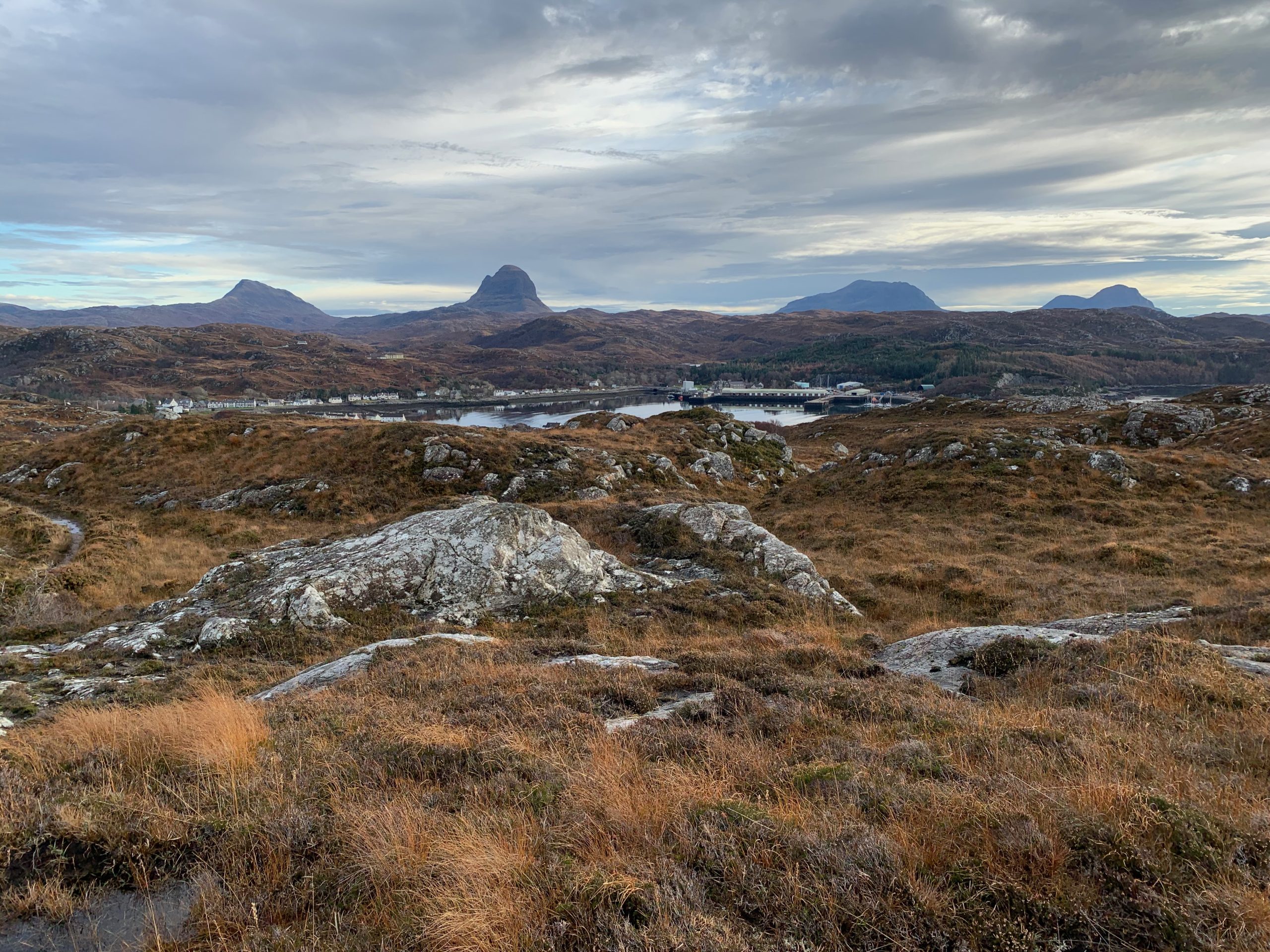
- Spectacular mountain views – passing many mountain ranges that are often considered to be the best the UK has to offer (The Assynt is our particular favourite 🙂 )
- Coastal scenery – from beaches to cliff-tops in areas that are remarkable but almost unvisited
- Visiting remote communities
- Superb opportunities for watching wildlife
Book Your Trip
Sign Up to be notified when new dates are added
Small groups, with a mix of solos and new friends
Expert guides, authentic mountain adventures
Pay in 3 interest free payments with PayPal
Looking for a Private Trip?
Get in touch to learn more about our private trip options.
Related Products
-
From £895.00 per person
-
From £545.00 per person
-
From £1,145.00 per person
-
From £265.00 per person
-
From £795.00 per person
-
From £795.00 per person


7 reviews for Cape Wrath Trail (Stage 1)
-
I am just back from a 9 day trip hiking and wild camping the north section of cape Wrath trail and what a trip has been. I have hiked in Scotland many times before but this trip has been so special that I couldn’t wait to write a review 1. Stuart’s Organization from the time i booked it, was impeccable. Any kit that you needed to borrow, diet constraints, any queries or questions, it was all so well organised. He was also very flexible with last minute flight cancellation for few of us and changed the plan for our first day to accommodate. 2. I had never camped before so wildcamping was a step too far out of my comfort zone but I guess that’s what I love about city mountaineering, they take pride In taking people out of their comfort zones and you feel so safe and supported. I am truly in love with wild camping after this trip and also feel I have graduated in tent pitching 😅 3. We were mostly off track and remote most of the time, Stu had planned the days so well, we hardly saw anyone. Wild camped at some of the most amazing spots. I could not think of a better way to see this part of Scotland. You couldn’t really see this on your own. Stuart’s passion and excitement about UK mountains rubs off on you. He doesn’t just want you to complete the trip but REALLY wants you to enjoy it. 4. The support crew during the trip to swap the kit and pick up food was so well thought and Ed was amazing even waiting for us 2 hrs on one day while we were late to reach the meeting point. It also meant that if there was someone struggling they had a way to exit or get a rest day. 5. Stu and the team really go out of their way to add the extra touches. From the barbecue feast on our final day in a beautiful coastal village to wine on the mountains to a beautiful drive back to the airport, the team always goes out of their way.
-
Unique experience every time. Guided through the best trails and scenery. Cozy moments in the middle of the wilderness. Wish I could give more stars.
-
Have already been on a few trips, the latest being the Cape Wrath trail. The planning by Stu is meticulous. It’s the little things that he does that really make a difference on a long day out. We were on the trail for 7 days and Stu was just the most incredible leader. It’s a proper detox from civilisation – I don’t want to reveal too much. There are trips for all abilities – from an easy day out in the mountains to something properly challenging over a period of a week. Book a trip, you won’t regret it! Darsh
-
I’m still on such a high from my 2 week expedition trek of stages 2 & 3 of the Cape Wrath Trail with City Mountaineering. Having never done more than 3 nights camping, nor carried my own full pack, I was quite nervous. Stuart’s meticulous organisational skills and intimate knowledge of the Scottish wilderness shone through and that put me at ease right away. He’s got a well thought through plan in mind but it’s fluid enough to accommodate any uncertainties (weather, midges, ground conditions, injury…). I was given options for taking a rest day but was thoroughly supported to stick with it and I’m so glad that I did. The small group size of 8 pax max is also ideal. Good for plenty of banter and camaraderie but also allowed me the time and space to be with my own thoughts. Back at work for just a day now and I’m already perusing the CM diary – I can’t wait to book my next trip!
-
Just back from an absolutely amazing two weeks on stage 2 and 3 of the Cape Wrath trail with City Mountaineering. The guides Stuart and Jonathan were friendly, organised and knowledgeable. They catered to everyone’s needs and flexed the itinerary when needed depending on the weather. The scenery was stunning – from sunrises, sunsets, rainbows and all the Scottish lochs, mountains and valleys in between, everyday was incredible. They always found us the best wild camp spots each evening and the small group size was a real bonus. We were very well looked after throughout the expedition and I would highly recommend this hiking adventure – whether for one stage of the trail or more!
-
The Cape Wrath trail (or the middle section to be precise) was a delight. You pack your rucksack with camping gear and kit and off you go into the wild. Rarely seeing other people even during the Easter Bank holiday. It is truly remote. Food was replenished every few days and we did have a bunk house mid way through with a drying room where we could feel suitable spoilt. I say bunk house, but it was more like a holiday cottage, a real treat. But, it is the wild camping which really stands out. Falling asleep in the silence of nature, stars in abundance, hot breakfast and dinner and delicious lunches. The days can be long but they are never hurried. Everyone in the group was lovely and we had Beinn the sprinter spaniel for company who put us to shame by running 3 miles for every one we walked. We had all the seasons in just one week, even a flurry of snow at one point. It’s tough enough to make you feel proud and very beautiful on the eyes, plus we saw new born lambs, deer, cattle and lots of birds. Stuart never put a foot wrong, he guided us through terrain I would have constantly got lost in and selected beautiful camping spots. A terrific week, why did it have to end?
-
Another fantastic expedition. Expertly guided through the middle section of the Cape Wrath trail by Stuart. Taking in beautiful mountains, valleys and lochs. Dramatic wild camping sites expertly chosen for the best protection from wind. Or to invite wind to fend of any threat of midges. Truly great food every day and much needed! And excellent support on the journey with checkpoints to adjust kit and restock supplies. Fantastic group. I laughed until I cried during the evenings as we relaxed before retiring to our tents. And when we reached our destination we were rewarded with a great hotel. Hot food and showers in abundance and a soft bed to rest in. My only regret was that it came to an end.